
What we do

Archaeology
Surveying by drone, our team will create detailed new maps of archeological resources along Wandel Dal, focusing initially on the area around Pearylandville beside Nedre Misommersø (Lower Midsummer Lake) and Deltaterrasserne in Jørgen Brønlund Fjord. Together with additional radiocarbon dates on archeological materials already archived in Nuuk and Copenhagen, we will refine the history and geographical extent of the occupation of Wandel Dal and adjacent areas. In addition to supporting the objectives of this project, the survey will provide help designate the area around Wandel Dal as a National Heritage Site.
key people: Fuuja Larsen, Hans Lange, Inaluk Schmidt Jacobsen, Christian Koch Madsen
photo: Independence I (Paleo-Inuit) bifaces from Pearylandville (Ole Woldbye)
Lake sediments
Lake sediments provide a continuous archive of the climate and environmental histories of lakes, catchments, and regions.
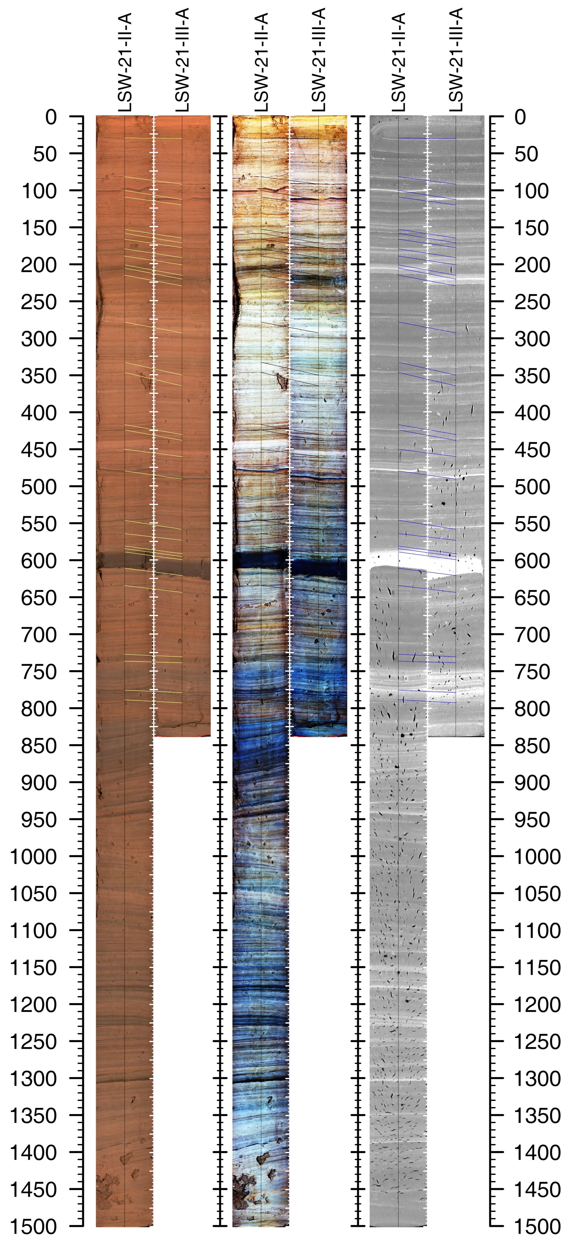
Our lake sediment work will focus on retrieving ~5000 year records from Nedre Midsommersø (Lower Midsummer Lake) and nearby lakes using piston and gravity cores from floating platforms.
Once home, the cores will be scanned using a CT scanner to document their sedimentology and stratigraphy at the sub-mm scale. Cores will also be scanned on a GEOTEK multi-sensor core logger to get line-scan images, magnetic susceptibility, and spectral reflectance data. Elemental profiles will be obtained using an ITRAX XRF core scanner.
Then we subsample the core for different analyses. They can be split into different groups:
chronology: plant material will be radiocarbon dated to constrain the age of the sediments and develop reliable age-depth models.
paleoecology: we will analyze the fossil diatoms, pollen and spores, chironomids, and sedimentary ancient DNA. They will tell us about past plant and animal life, ice cover, and aquatic productivity.
paleothermometry: Using lipid biomarkers (alkenones, brGDGTs, and plant waxes) and chironomids, we will develop multiple quantitative temperature records using these well-established approaches.
paleohydrology: differences between reconstructed hydrogen isotopic values of precipitation from leaf waxes and the above temperature reconstructions can tell us about changes in moisture-source through time, sea ice extent, and the seasonality of precipitation.
key people: Ray Bradley, Billy D’Andrea, Nick Balascio, Bianca Perren, Jostein Bakke, Aart Verhage, François Lapointe, Tobi Schneider, Inger Alsos, Donna Francis, Scott Anderson
photo: CT scan of a lake sediment core from Lake SW (aka Lake Tobias) near Wandel Dal showing core colour and density changes. Depth scale is in mm. (Tobi Schneider)

Modelling
We will model past sea ice and ocean circulation in order to understand the availability of open water in the region and role that ocean circulation may have had in Paleo-Inuit migration.
We will simulate how the location, extent, and duration of polynyas around northern Greenland varied during the late Holocene (last ~5000 years) and how these changes could have provided or restricted opportunities for Paleo-Inuit to hunt marine mammals and use ice-bridge corridors for migration.
key people: Alan Condron
photo: glacier tongue and outlet rivers, Wandel Dal (Tobi Schneider)